BiddingPulse research
What a BiddingPulse unlock opens, view by view
Satellite and layout views, satellite history, Street View, sun and facing, nearby places, a cost plan and checks: what each view shows, and where it stops.
In short
- The official facts are free on every page: the reserve price, the deposit, the dates and the notice itself.
- An unlock adds our research on top: where the plot is, what is around it, how the sun falls on it, and what it would cost at the bid you have in mind.
- Every figure is marked as either a fact from the notice or our estimate. Our drawings are approximate, not a survey.
- If we cannot draw a view for a page, the page says so before you pay. Its unlock card lists only what it opens.
- Read it before you visit the site. It does not replace the visit, the official documents or your own checks.
What an unlock opens
The official facts are free. An unlock adds the research that explains them.
Every auction page starts with the public record: what is on offer, the reserve price, the deposit, the dates, and the official notice to check them against. That part is free, for everyone, always.
An unlock opens the work we do on top of it. We put each plot on a map, redraw the authority’s plan, look at what is around the plot, work out how the sun falls on it, and turn the notice’s payment terms into a plan you can try with your own bid.
A page shows a view only when the evidence is good enough to draw it. Where it is not, the page says so in plain words.
| View | What it answers | Built from |
|---|---|---|
| Satellite view | What is on and around the site today? | Google satellite imagery |
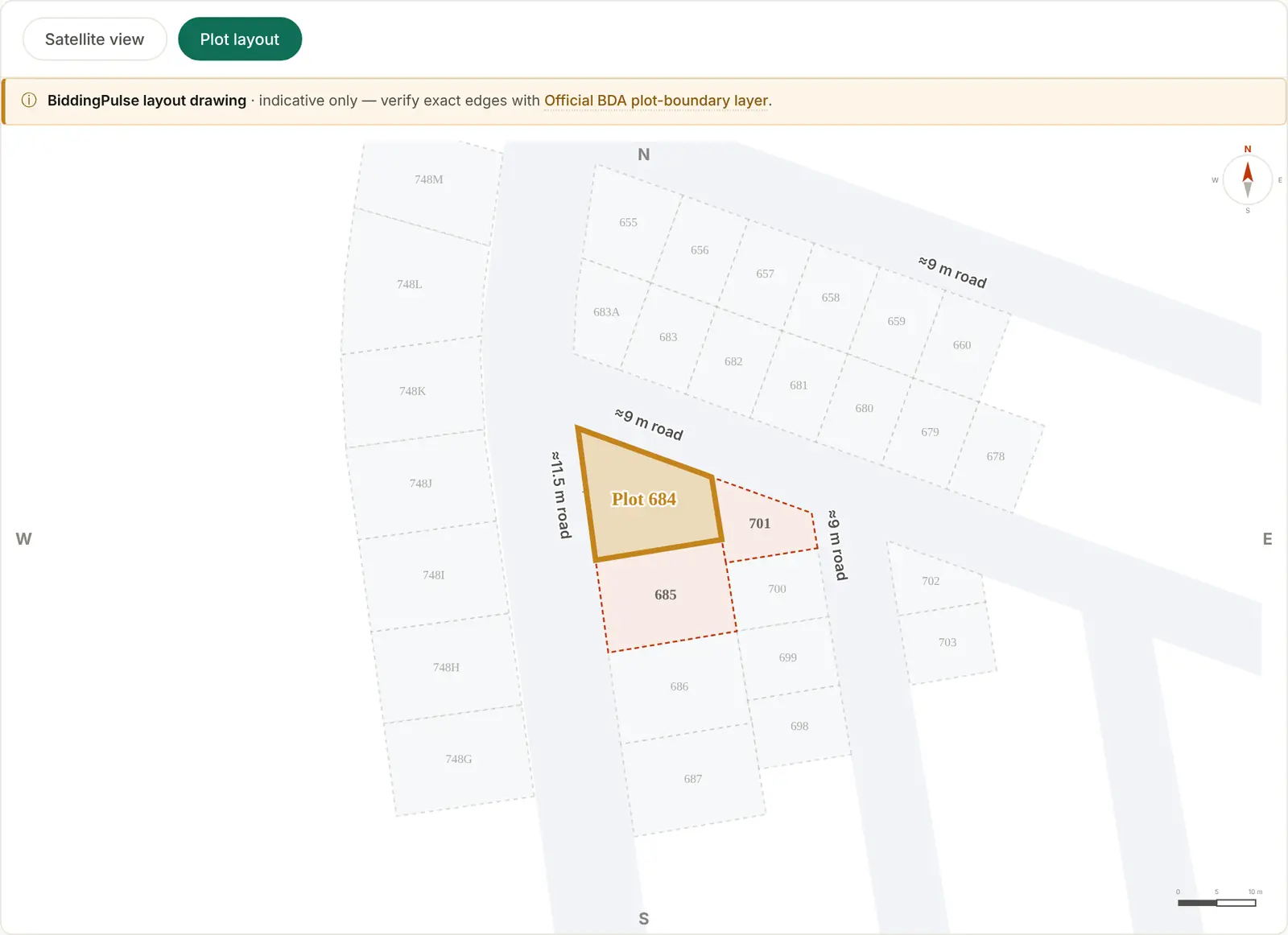
| Layout drawing | Which parcel is it, and how does it sit in its block? | The authority’s layout plan, redrawn by us |
| Street View | What does the approach look like from the road? | Google Street View |
| Satellite history | What has changed on the site over the years? | Esri World Imagery Wayback |
| Cost planner | What do I pay, and when, at my own number? | The notice’s payment terms, plus duty estimates |
| What each side faces | What is on the other side of each edge? | The layout drawing and the notice’s boundaries |
| Sun around the plot | Where does the sun fall, by hour and by season? | A solar model run over the layout drawing |
| Nearby and key updates | What is close by, and what has changed recently? | Named public sources, each linked |
| Brief, comparisons, history | What happens next, and how did earlier rounds go? | The notice, and earlier official records |
| Checklist and source trail | What should I confirm before paying the deposit? | Our research, cited to each document |
Not every page has every view. The unlock card on each page lists exactly what that page opens.
Most used
Satellite view
See the site and its surroundings before you travel.
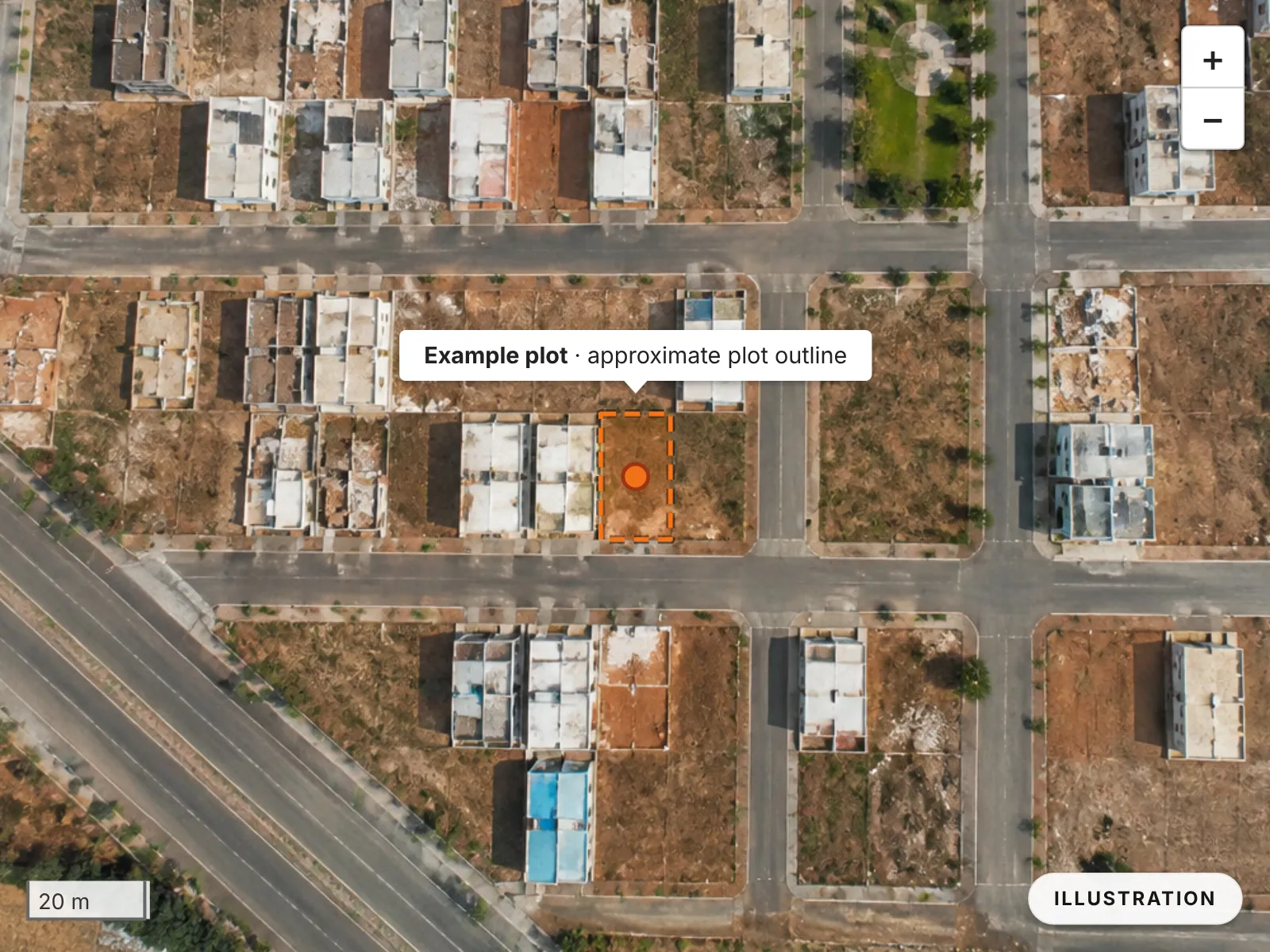
The satellite tab opens on the plot, marked on current Google satellite imagery. With a free account you can look about 2 km around it. With an unlock you can move up to 10 km away and zoom out to the whole state, to see where the plot sits in the city and which roads lead to it.
The imagery is a photograph, not a plan, and it may be months old. The outline on it is our approximate placement, and the layout drawing is our redrawing of the authority’s plan: neither establishes the legal boundary, the title or the right of access. Check those in the authority’s own records, with your own surveyor or lawyer where it matters.
Most used
The layout drawing
See which piece of ground the notice is selling.
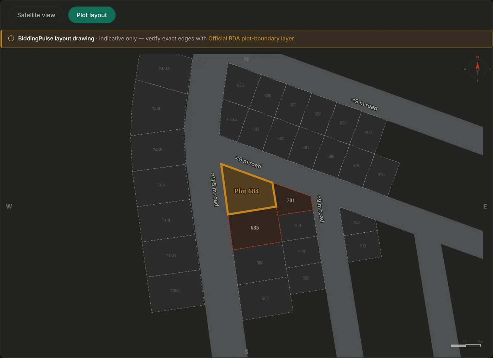
Authorities publish layouts as scanned plans. They are often sideways, hard to read on a phone, and not tied to a map. We redraw the plan with north at the top, outline your plot, mark the road widths and lay it over the satellite image, so you can see which piece of ground the plan means.
Each drawing names the plan it came from and says how sure we are of the placement. If the authority publishes its own map pin, the page shows it and points out where it differs from ours. If we cannot place a plot, the page says so rather than guess.
With an unlock
Street View
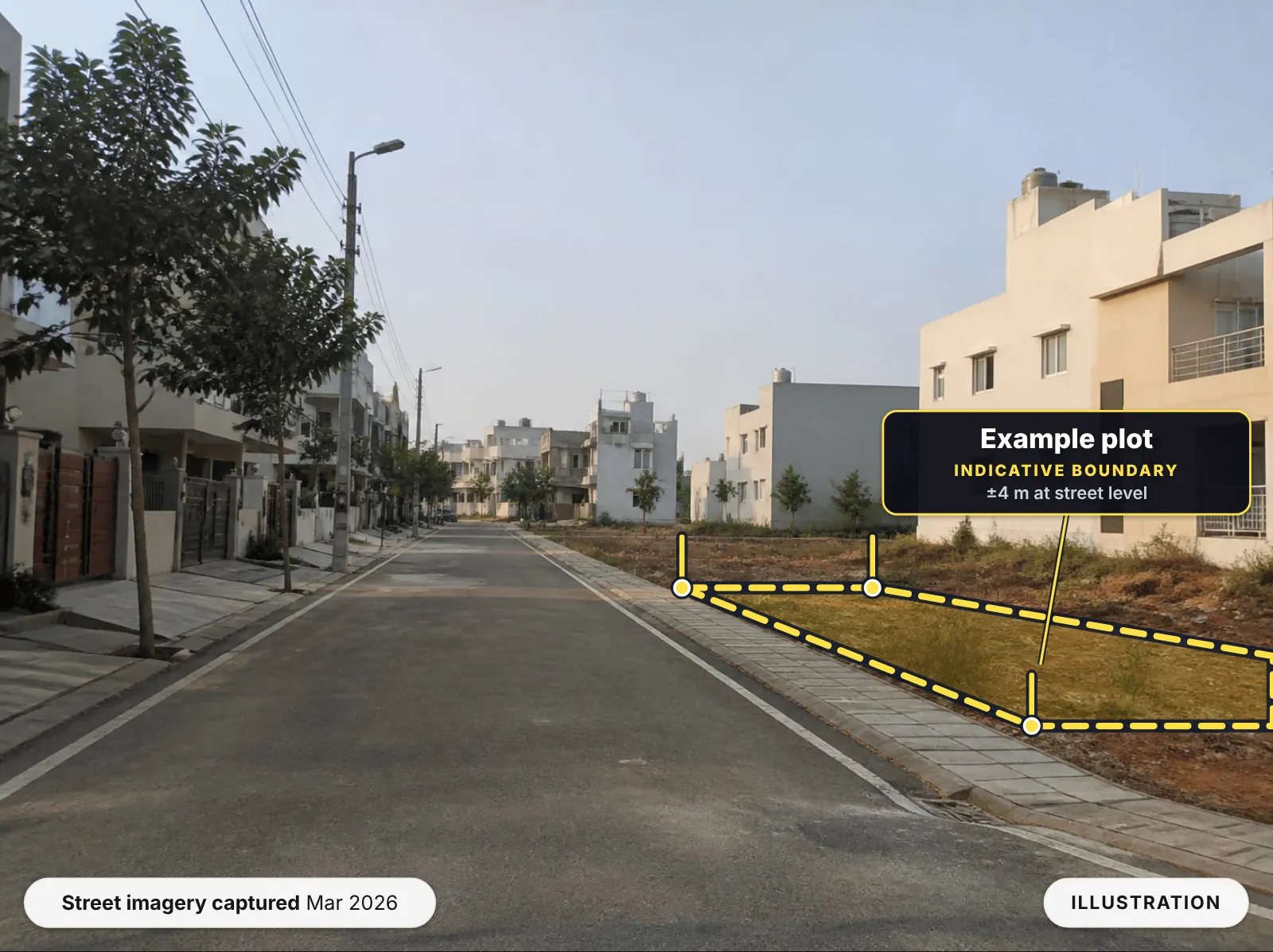
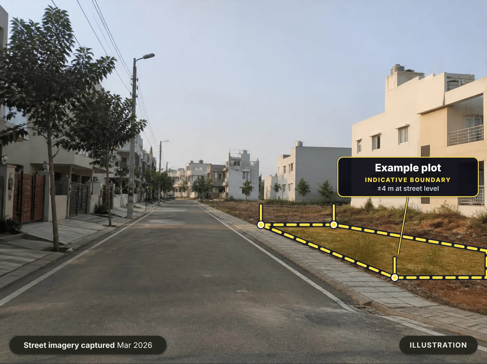
Stand on the road in front of the plot, with its outline drawn into the scene.
The Street View tab opens Google’s 360° street view on the road in front of the plot, facing it, with the plot’s approximate outline drawn in where we have one. If the authority gives only a map pin, we mark the pin instead. Every view shows the month Google took it. — per Google Maps Platform’s Street View documentation.
Google has not photographed every new layout. If it has nothing near the plot, the tab says so and shows where its coverage does reach, rather than opening a view of somewhere else.
Street View opens only with paid access, so the sample pages do not show it.
With an unlock
Satellite history
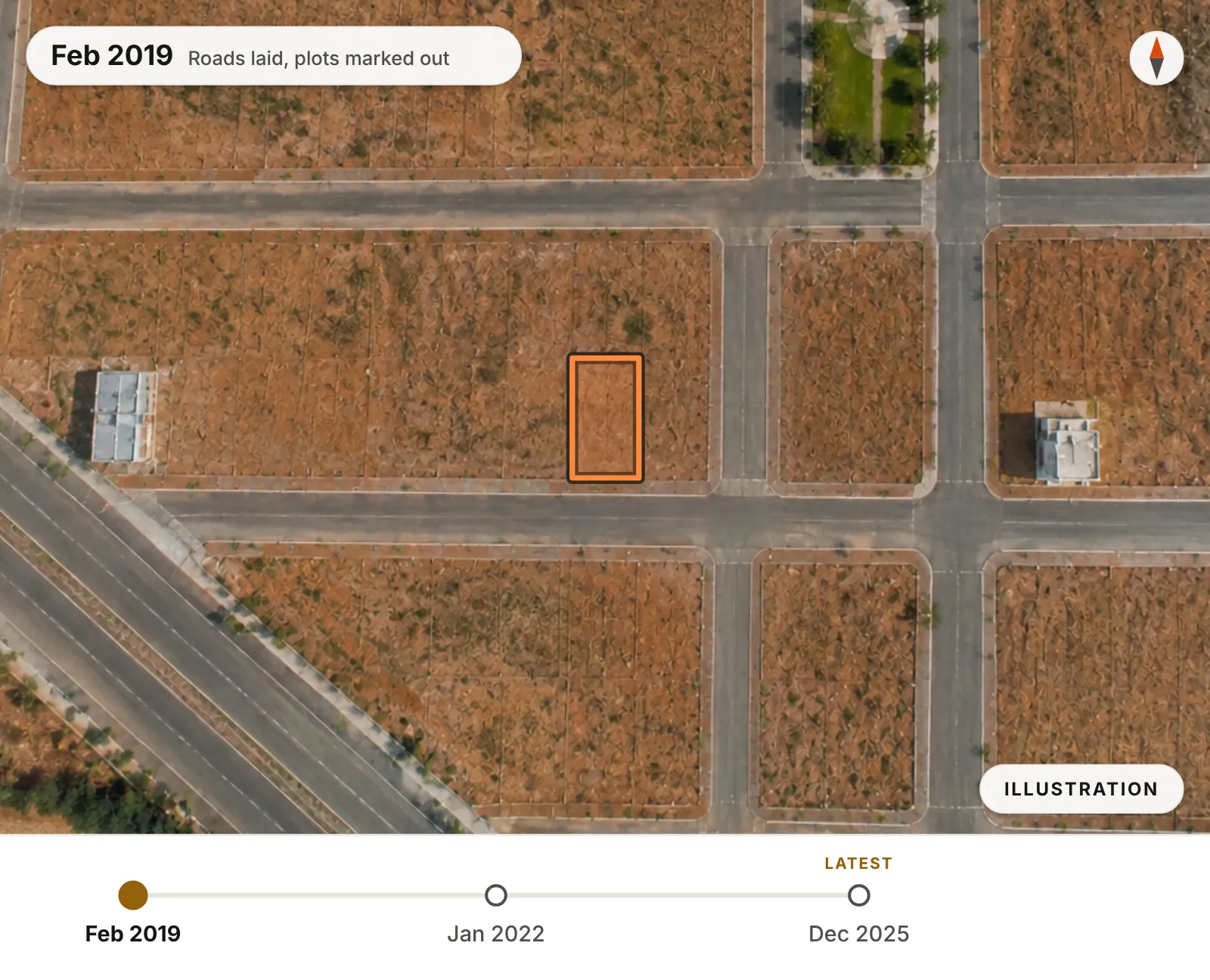
See what was on the site before: roads going in, buildings going up or coming down.
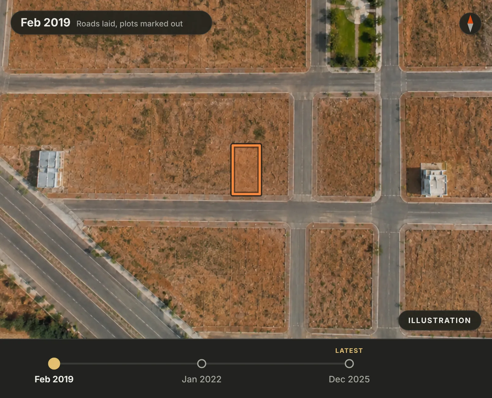
The history tab steps through archived satellite captures of the plot, oldest to newest. You can see when the roads were laid, whether anything was built and then cleared, and how the neighbourhood filled in.
The captures come from Esri’s World Imagery Wayback archive. Each frame carries the date it was taken and the credit of the company that took it. — per Esri’s World Imagery Wayback archive.
These are photographs, not measurements or ownership records. There is usually a year or more between two photographs, so a change between them could have happened at any point in that gap.
Satellite history opens only with paid access, on open and closed auctions alike. There is no free sample.
Your bid
The cost planner
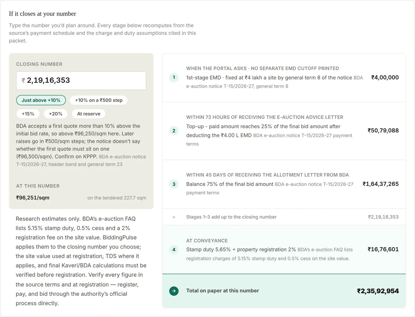
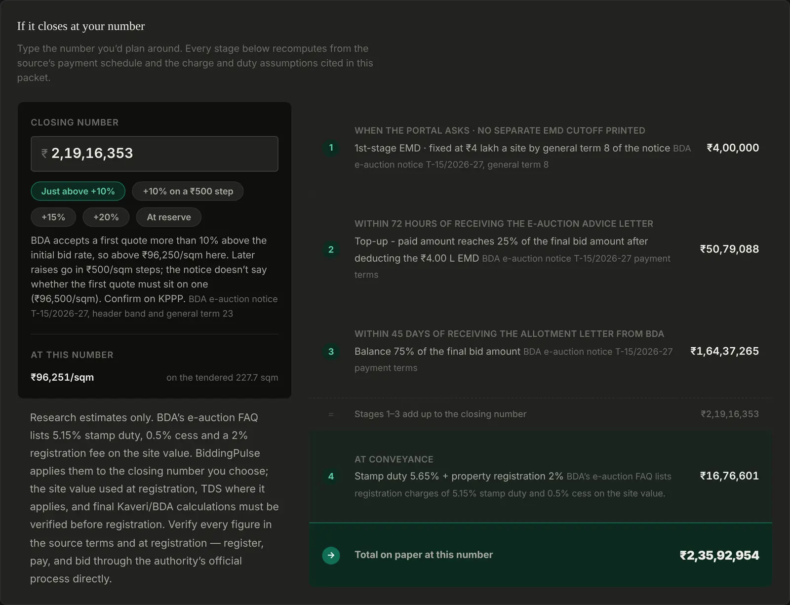
The reserve price is where bidding starts. This shows what you would pay in all, and when.
Type in the bid you have in mind. The planner splits it into each payment the notice asks for, with its deadline, and adds estimated stamp duty and registration fees. Change the bid and every payment updates.
The payments and deadlines come from the notice, with a reference to it. Stamp duty and registration are our estimates from the state’s published rates, and are marked as estimates. If a notice does not set out its payments clearly enough, the page leaves the planner out rather than guess.
Neighbours
What each side faces
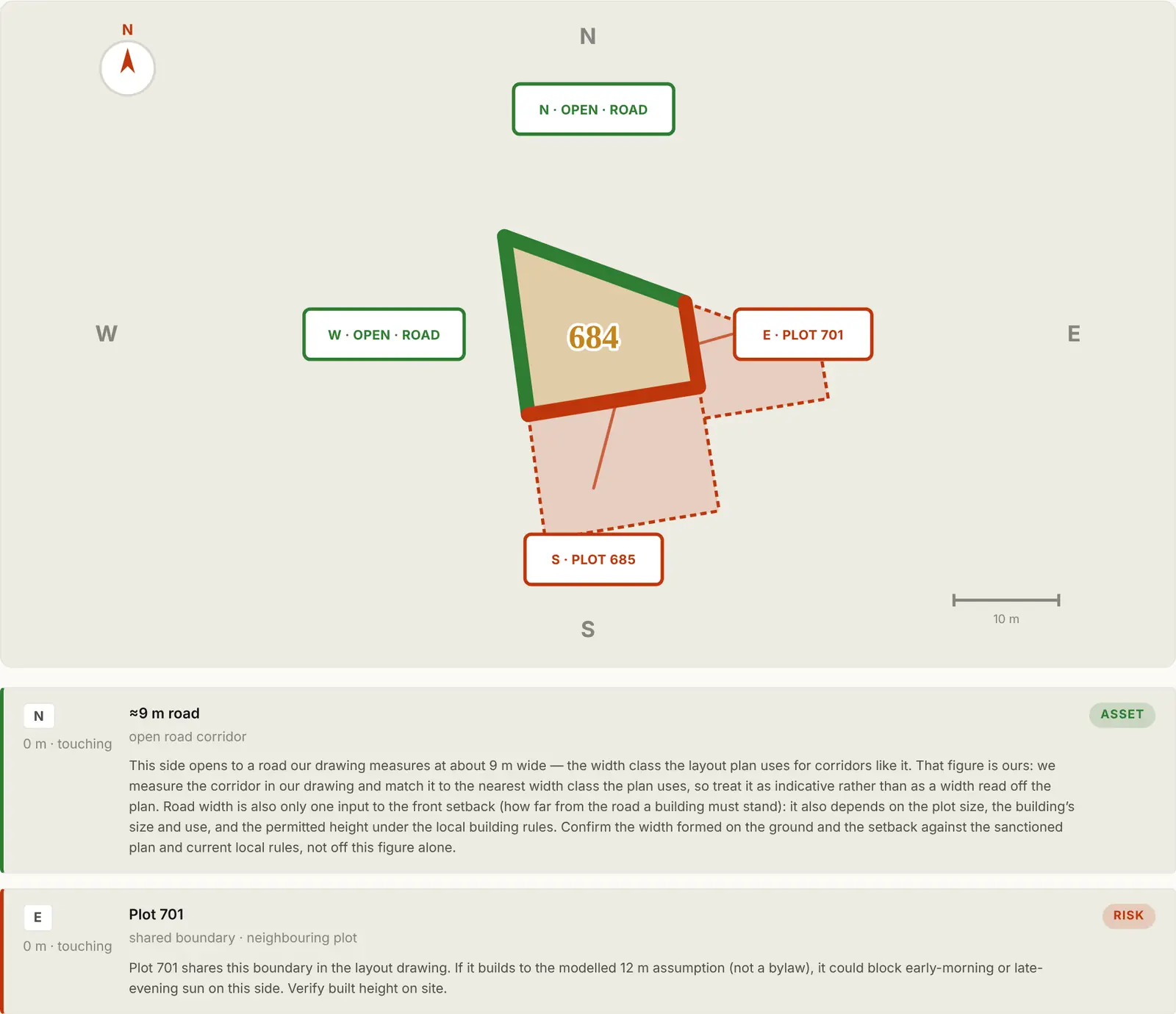
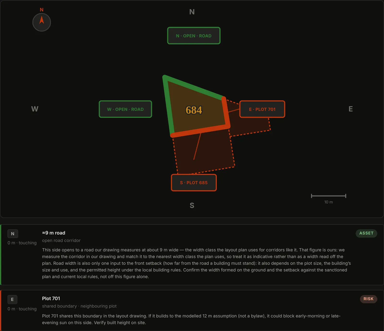
Two plots of the same size can be very different places to live.
This view colours each side of the plot by what is next to it. Green for good things, such as open space, a green belt or a main road. Grey for neutral sides, such as an internal road. Amber for things to check, such as a neighbouring plot that could be built up to the full height local rules allow.
If the notice lists what borders the plot on each side, we show the authority’s words next to our drawing and point out any difference.
Light
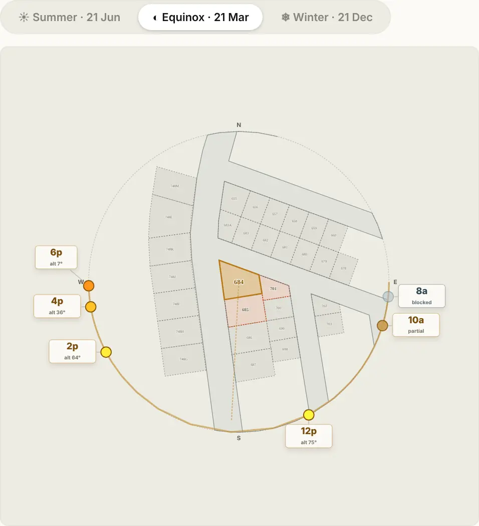
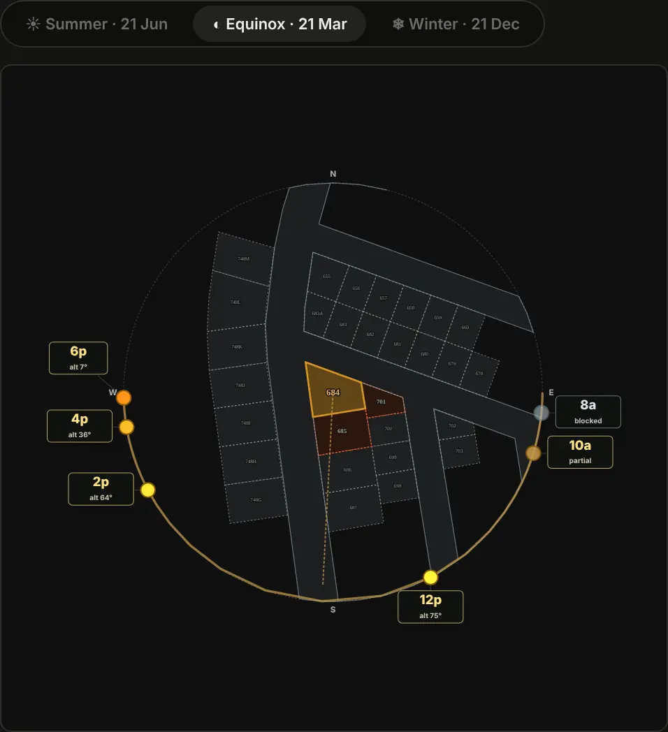
Sun around the plot
Where the sun falls on the plot, hour by hour and season by season.
The sun model follows the sun around the plot through the year. It estimates how much direct sun the plot gets, hour by hour and month by month, at several points on the plot, allowing for shade from the neighbours.
The sun’s position comes from the published solar equations of the US National Oceanic and Atmospheric Administration (NOAA), worked out for the plot’s own location. — per NOAA Global Monitoring Laboratory’s General Solar Position Calculations.
Nobody knows yet what will be built next door, so the model assumes a height for each neighbour and shows that assumption beside the result. If we are not sure enough where the neighbouring plots are, the page shows the sun’s path but leaves out the shade estimate.
Around the site
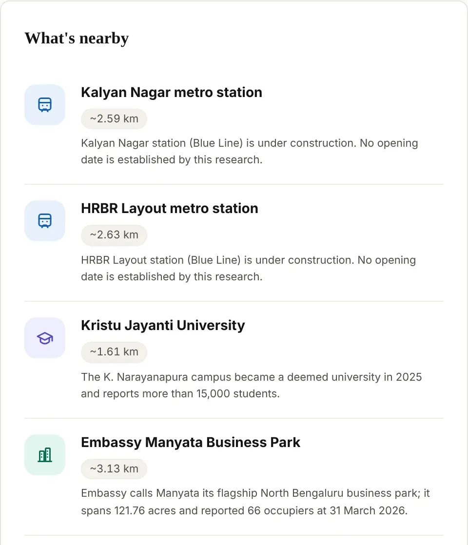
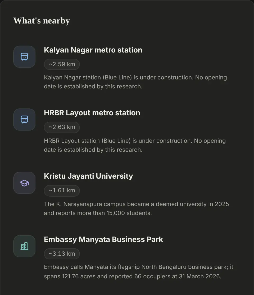
What’s nearby and key updates
What is close by, and what has changed lately, each with its source.
What’s nearby lists the places you use day to day, such as metro and bus stops, schools, hospitals, markets and parks, with the distance to each. Distances are in a straight line, not by road, and the list says so.
Key updates collects recent changes: corrections to the auction notice (corrigenda), work on the site, and infrastructure projects nearby. Each item links to where it came from, so you can read the original.
Context
Bidding brief, comparisons and listing history
What happens next, and what happened the last time this plot was offered.
The bidding brief lists the next steps in order, such as the deposit, the auction itself and the payments, each with its date and the part of the notice it comes from.
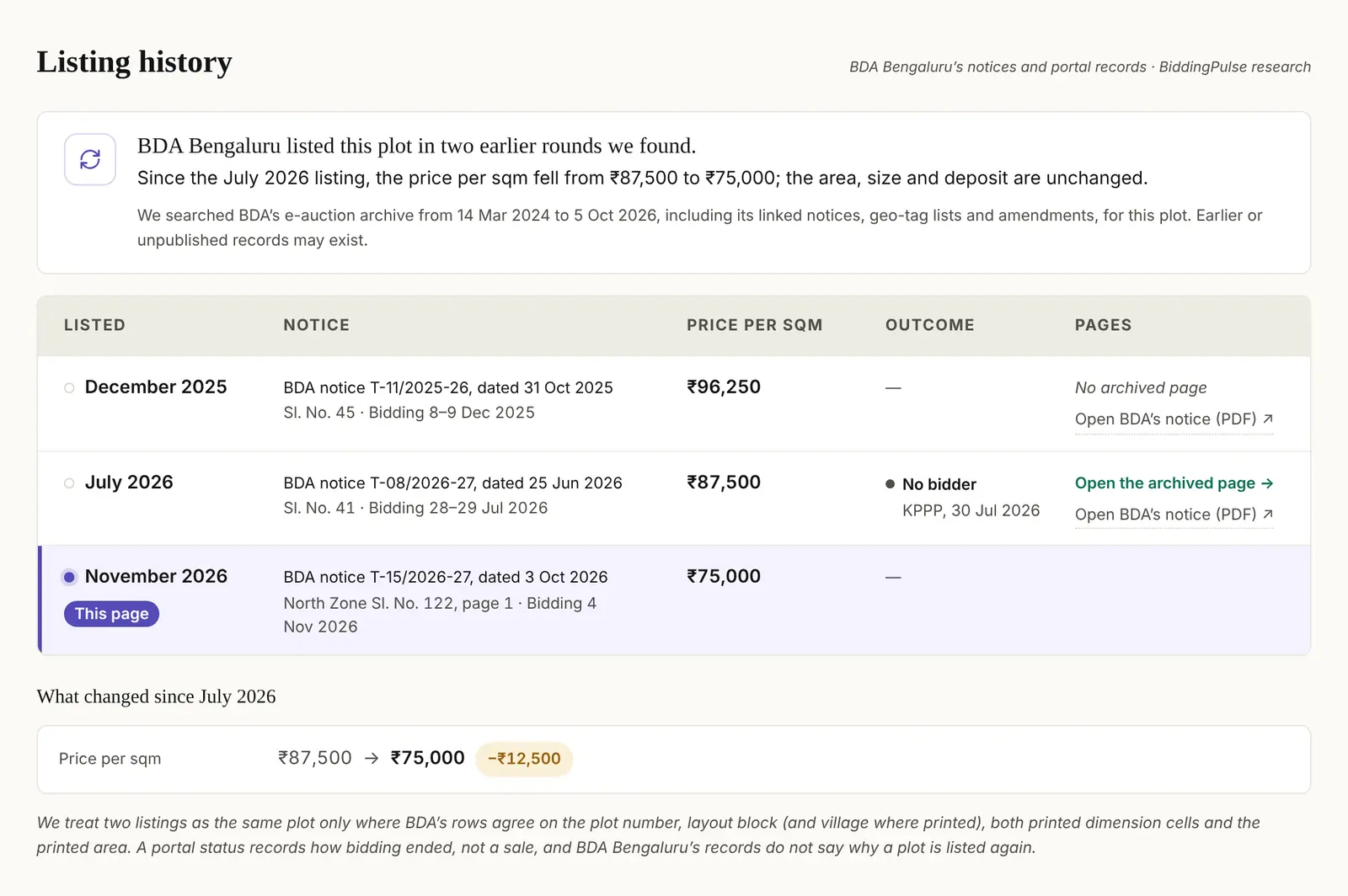
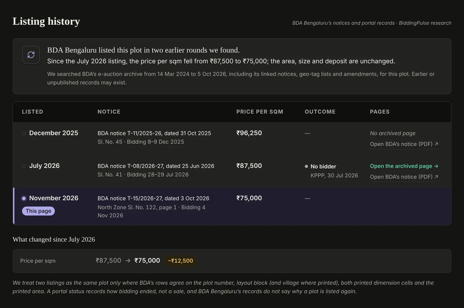
If the same pocket was auctioned before and the authority published the results, a table puts today’s reserve price next to those earlier results. They are the authority’s own figures, copied exactly. They are not a forecast for this plot.
Listing history shows earlier auctions where we found the same plot on offer, and what changed between them. It appears only where we have searched those earlier auctions.
Before the deposit
The checklist and the source trail
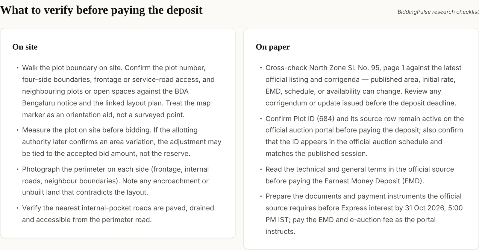
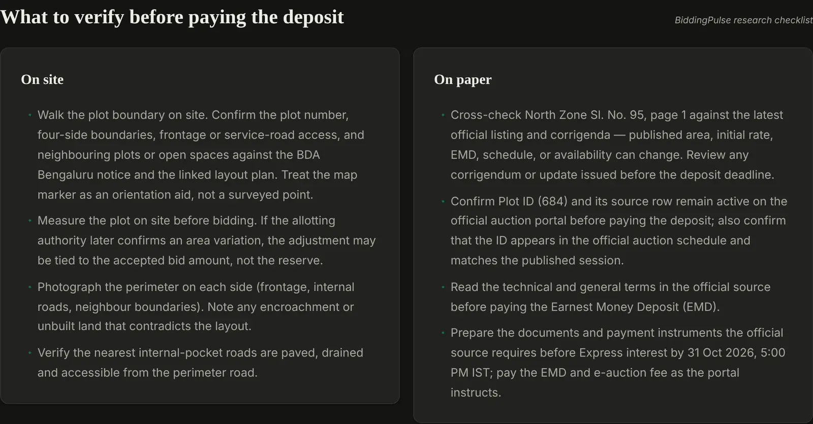
What to confirm on site and on paper, and where every figure came from.
Every unlocked plot ends with a checklist of what to confirm on site and on paper before you pay the deposit: the boundary on the ground, the access road, the plan and the payment deadlines.
Every figure comes with its source: the document, the page and the line. An unlock shows all of them, and our calculations, so you can check any number against the authority’s own.
What comes from the notice, and what is our estimate
Every figure is one of two kinds, and the page always says which.
Notice facts are copied exactly from the authority’s documents, with a reference to each. Estimates are our own calculations, marked as estimates, with how we got them shown alongside. If the two disagree, go by the notice.
| On the page | Kind | Where it comes from |
|---|---|---|
| Reserve price, deposit, auction dates | Notice fact | The authority’s notice, copied exactly |
| Plot number, size, printed boundaries | Notice fact | The notice and its schedule of plots |
| Payment stages and deadlines | Notice fact | The notice’s payment terms |
| Earlier rounds’ results | Notice fact | The authority’s published results |
| Plot position and outline on the map | Research estimate | Our drawing of the layout plan over imagery |
| What each side faces | Research estimate | Our drawing, checked against the notice |
| Sun and shade | Research estimate | A solar model with stated assumptions |
| Distances to nearby places | Research estimate | Straight‑line measurements |
| Stamp duty and registration | Research estimate | The state’s published rates applied to your number |
Some notices give a rate instead of a reserve price. Where we work the reserve out (area × the published rate), the page says so next to the figure.
Apartments
Flats and towers
The brochure gives you the floor plan. The research tells you what it leaves out.
A brochure shows the rooms. It does not say what the flat looks out on, how much sun each room gets, or how close the next tower stands. That is what our flat research adds.
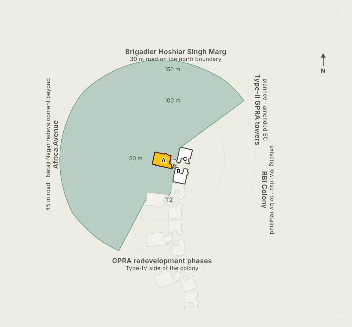
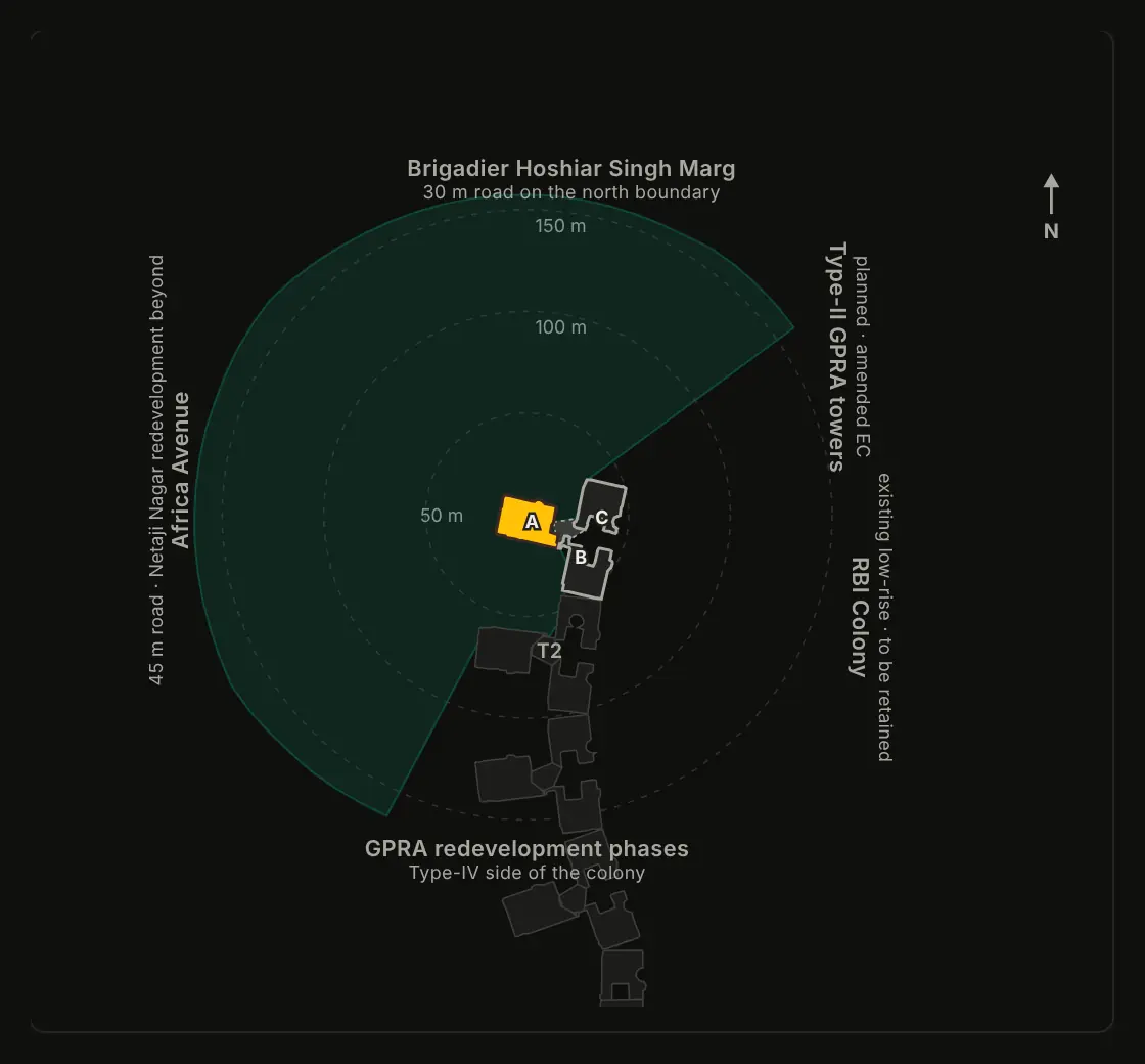
Each tower page shows what is around every wing, such as roads, neighbouring colonies and the other towers, and how far each wing can see before another tower blocks the view. It also shows how the sun moves around the tower through the year.
Each flat page shows where the flat sits in its wing and which way each room’s windows and balconies face. It estimates the hours of direct sun each room gets in each season on that floor, and builds a payment plan at your own price.
Flat research opens only with paid access, and there is no free sample flat. NBCC Avenue Towers, our first apartment release, is sold with Premium only. Insight and the pass do not cover it.
When a view is missing
We would rather leave a view out than draw one we cannot stand behind.
The usual reasons: the authority publishes a list of plots but no layout plan; the plan is too unclear to place on a map; Google has no street photos near a new layout; or we are not sure enough of the neighbouring plots to estimate shade.
You will know before you pay. The unlock card on each page lists what that page opens, and a page that cannot place its plots on a map says so above the card.
Our part, and yours
How to use this research
Research to prepare you for the site visit and the auction. It does not replace either.
A notice gives you a plot number, an area and a reserve price. The research adds what the notice leaves out: where the plot sits, what its sides face, what it may cost in all, how earlier rounds went, and what to confirm before the deposit. A buyer who has read it goes to the site knowing what to look for and what to ask.
It cannot replace seeing the site, reading the papers or your own judgement. Imagery can be months old, our drawings are approximate, and official records can change after we read them. Read it before a site visit, not instead of one.
- Read the research. Start with the layout drawing and what each side faces, then the costs at your own bid and the earlier auctions. You will know which plot you are looking at and what it may cost in all.
- Visit the site. Take the checklist and the authority’s plan. Walk the boundary, find the plot number on the ground, and look at the access road, drainage, levels, overhead lines and anything built on or beside the plot.
- Check the papers. Read the latest notice and every corrigendum yourself. Confirm eligibility, the payment schedule and the conditions of sale with the authority, and have a lawyer you appoint check the title and the terms.
- Decide on the official record. The decision is yours. Register, pay and bid only through the authority’s official process, and where our research and the official documents differ, go by the official documents.
Common questions
Can I decide on a plot from BiddingPulse alone?
No. Read the research alongside a site visit, the official notice and its corrigenda, and checks by professionals you appoint, such as a lawyer for the title. It prepares you to ask better questions; it does not answer them on the authority’s behalf. Where it differs from the official documents, go by the official documents.
Can I see the research before I pay?
Yes. The sample area and sample plot are fully open to every visitor, and show the views most pages carry: the satellite and layout views, what each side faces, the sun model, nearby places, the costs, the brief and the checklist. Street View and satellite history are the two views the sample does not open.
What does a BiddingPulse unlock include?
A BiddingPulse unlock opens the research on an auction: the plot on satellite and on our redrawn layout, Street View with the plot’s approximate outline, satellite history, a cost planner at your own bid, what each side faces, the sun model, nearby places and key updates, the bidding brief, earlier auctions and a checklist. Each page lists exactly which of these it carries.
I am buying from abroad. How much can I check without visiting?
Satellite, Street View and satellite history show the site, its approach road and how it has changed, without a visit. They are not a substitute for one: before paying a deposit, have someone you trust walk the boundary with the authority’s plan and confirm the plot number and access road.
Is the layout drawing a survey?
No. It is our redrawing of the authority’s published plan, placed over satellite imagery, and it is approximate. Confirm the boundary, the plot number and the access road on site, against the authority’s own plan, before you pay a deposit.
Are the reserve price and the deposit behind the paywall?
No. The reserve price, the deposit, the dates and the link to the official notice are public facts, and they are free on every page. An unlock opens our research built on top of them.
Where do the satellite, history and Street View images come from?
Current satellite imagery and Street View come from Google Maps Platform. Satellite history comes from Esri’s World Imagery Wayback archive. Each image carries its provider’s credit, and the history and Street View frames show when they were captured. — per Google Maps Platform’s and Esri’s published documentation.
Which plan opens these views?
Every paid plan opens the same views. The plans differ in how many auctions they cover and how much of the satellite map you can load. Insight covers one project, the Auction Research pass every open auction from one authority, and Premium every open and past auction we cover. The one exception is NBCC Avenue Towers, our first apartment release, which is sold with Premium only. The plans guide sets out each plan’s price and map allowance.
Sources
This guide describes BiddingPulse’s own research and plans. Where a statement rests on a map or imagery provider, a scientific method or our published terms, it is cited beside the text and the document is linked below. Prices and windows are the ones charged at checkout. Lines without a citation are our own description of our work.